 |
About Akokala Lake Trail
- Trail Highlights – Pristine views, alpine lake, plentiful wildflowers and wildlife.
- Roundtrip Length – 11.6 miles
- Elevation Gain – 1,105 feet
- Peak Elevation – 5,135 feet
- Parking Lot – Yes
- Difficulty – Moderate
- Region – Bowman Lake
- Availability of Water – Yes
Hiking to Akokala Lake
The trail to Akokala Lake begins at the Bowman Lake Campground, which is on Bowman Lake Road, 5.5 miles from the junction of Glacier Drive in the northwestern section of Glacier Park, near my favorite spot in Glacier, Polebridge.
There’s ample parking at the campground. This is a moderately easy day hike to a small, relatively low elevation lake just northwest of the larger Bowman Lake. You’ll cross mountain ridges and valleys along the way, with some beautiful views of the surroundings, plentiful wildflowers and wildlife.
As you set of on the trail, you’ll begin climbing to the saddle of Numa Ridge Lookout. At 1.5 miles, you turn eastward and begin a somewhat steep descent before you climb back up to a ridge with a great view of the valley below.
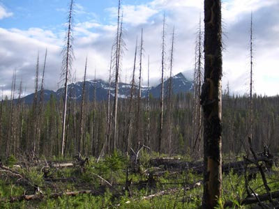
You’ll begin another descent for a little under a mile through tall lodge pole pines until you get to Akokala Creek at 3.4 miles from the trailhead. At this point you turn right to stay on the trail.
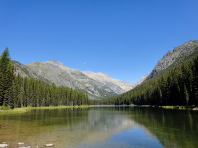
You’ll be heading northeast at this point and you’ll get a nice view of the lake at mile 5.5. Another .3 miles you reach the lake’s southern shore, with spectacular views of the surrounding mountain walls rising up around you.
This is a primo camping spot, if you decide to stay the night. Be sure to get a backcountry camping permit if you are going to camp.
Akokala Lake Trail Photos
 |
 |
Additional Glacier National Park Hiking Info
Check out other Glacier National Park hiking trails, or head back to the hikes in the Bowman Lake area.
Return home to Glacier National Park Travel Guide


Speak Your Mind